This past year has been one of growth and change for Urbanize - highlighted by the addition of new sites covering Atlanta, Austin, Chicago, Detroit, and New York. And to follow the lead of one of our sister sites, we will be publishing a series of year-end tournaments this month to let our audience decide what the top L.A. real estate, architecture, and urban planning stories of the past year have been.
To kick things off, “What's the best L.A. transportation project of 2021?"
There are a handful of big-ticket items which were scheduled to open in 2021, but for a variety of reasons have fallen short of that mark (looking at you Regional Connector and Crenshaw/LAX Lines). Nonetheless, bus lanes, bike lanes, and other streetscape projects have (or at least have the potential to) transform neighborhoods for the better. The poll (which you can find at the bottom of the page) closes Thursday afternoon.
Let's take a look at our candidates:
 Rendering of new protected intersection coming to 17th Street & Broadway City of Santa Monica
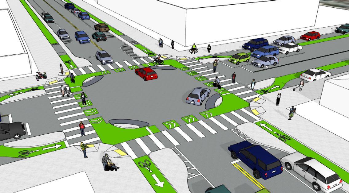
Protected bikeway, safety measures near 17th St / SMC Station Citing an increase in the number of cyclists and pedestrian activities since the arrival of the E Line in 2016, the City of Santa Monica broke ground earlier this year on a new protected bikeway and other safety infrastructure projects to the streets surrounding Metro's 17th St / SMC Station.
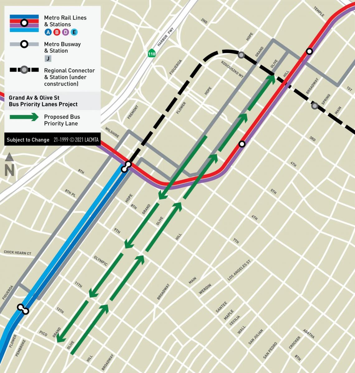 Grand Avenue and Olive Street bus priority lanes projectMetro
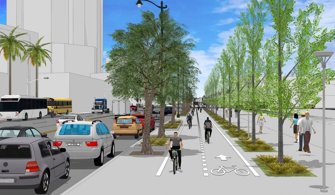
Bus priority lanes on Grand and Olive in DTLA Downtown's collection of bus-priority lanes continued its slow, steady expansion this year with the addition of a new north-south couplet on Grand Avenue and Olive Street - corridors which see 120,000 passengers each weekday. Downtown's other bi-directional couplets include north-south lanes on Figueroa and Flower Streets, as well as east-west lanes on 5th and 6th Streets.
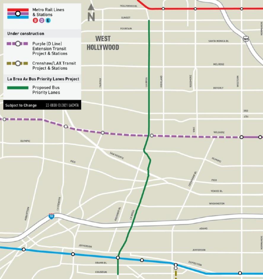 The 5.9-mile segment of La Brea between Sunset Boulevard and Coliseum Street slated for priority bus lanesMetro
La Brea gets into the bus lane business Metro and LADOT have been busy restriping streets in Downtown to improve travel times for the regional bus network. Those efforts drifted every-so-slightly westward last year with plans for peak-hour lanes on Alvarado Street, and are poised to take their biggest leap yet with proposed bus lanes along 5.9 miles of La Brea Avenue between Baldwin Hills and Hollywood. Before the onset of the global pandemic, Metro buses on La Brea saw an average of 12,500 weekday passengers.
New car-free streets pitched for DTLA Downtown, by design, is one of the region's few large, walkable neighborhoods. City Councilmember (and prospective Mayor) Kevin de Leon hopes to expand upon those offerings by closing segments of Grand Avenue, Broadway, and Traction Avenue to automobile traffic to create pedestrian malls. The pedestrian malls would be implemented intermittently on a trial basis (after a feasibility study) prior to any permanent closure.
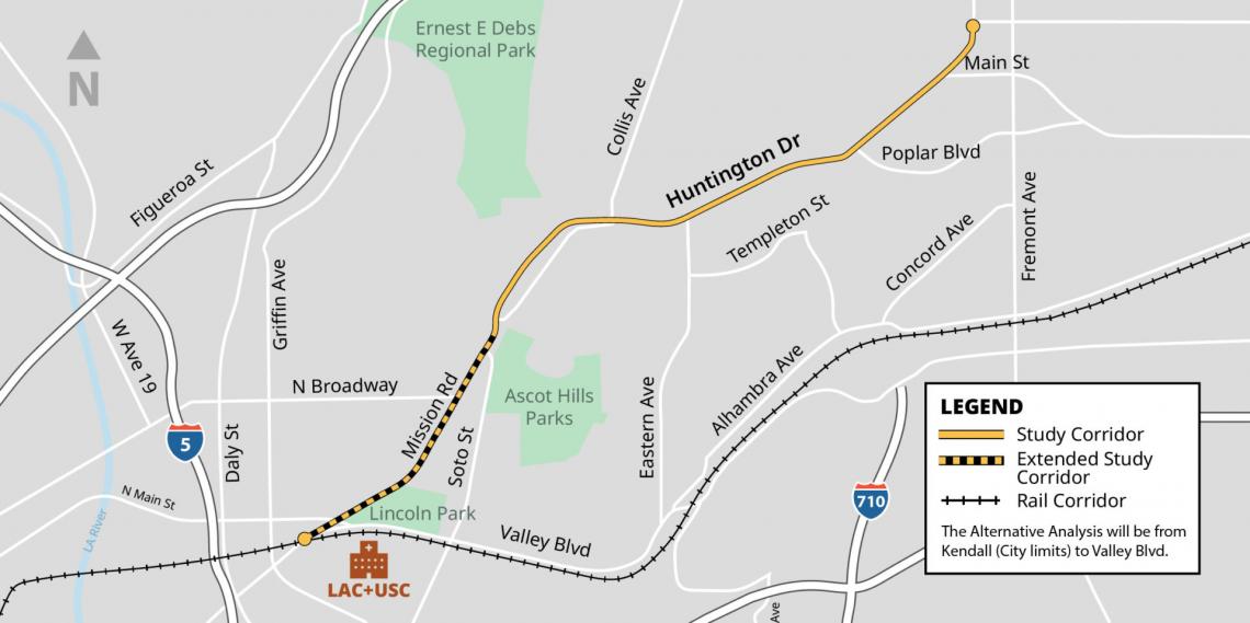 Study area for the Huntington Drive Multi-Modal Transportation Improvement ProjectCity of Los Angeles
710 extension money funds transportation goodies on the Eastside The 710 extension, the controversial freeway project which has died a dozen deaths, seems to finally have been put to rest. And the money that would have gone toward a new highway to South Pasadena will instead go toward new transportation projects on the Eastside - including potential bus rapid transit lines serving Huntingon Drive and Valley Boulevard.
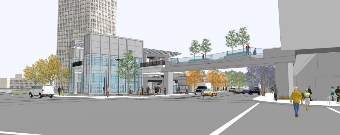 Rendering of the new bridge at 2nd/Hope StationMetro
A Downtown pedestrian bridge that people actually want Earlier this year, Metro began construction earlier this week for a new pedestrian bridge connecting to the Grand Ave Arts/Bunker Hill Station that is being built as part of the 1.9-mile Regional Connector subway in Downtown. The new bridge, which will span across Hope Street to the north of General Thaddeus Kosciuszko Way, will link the station with a pedestrian plaza adjacent to The Broad contemporary art museum.
 Rendering of the new esplanade and double row of street trees on Alameda StreetMetro
Esplanade, pedestrian improvements near Little Tokyo/Arts District Station Construction also began this year for the Eastside Access Improvement Project, a $29.7-million initiative which will bring new pedestrian and bicycle infrastructure to key corridors located within a one-mile radius of the new subway stop now taking shape at 1st Street and Central Avenue in Little Tokyo. A key element of that project, an esplanade along Alameda Street, will eventually connect with a complementary project at the front door of Union Station.
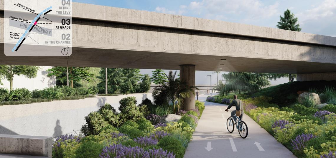
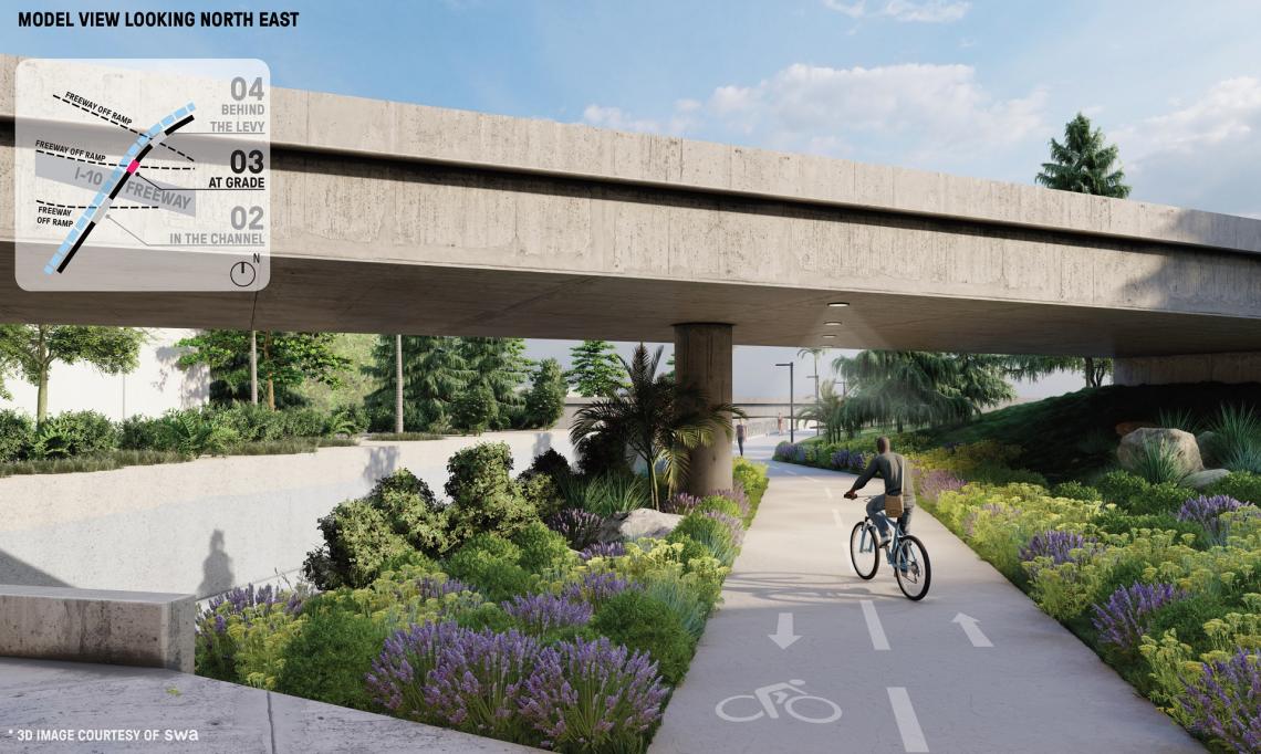 Undercrossing below I-10 rampSWA
Grassroots plan to extend the Ballona Creek bike path Earlier this year, safe streets and active transportation advocacy group Streets For All launched a grassroots proposal to extend the Ballona Creek bike path to Mid-City. The proposed project would complete the original vision of the path, extending its reach by approximately two miles to the intersection of Cochran Avenue and Venice Boulevard.
 MOVE Culver City project mapCulver City
MOVE Culver City, which opened in November, spans a roughly 1.3-mile corridor between Duquesne Avenue to the west and La Cienega Avenue to the east. Painted bus and bike lanes along the route connect Downtown Culver City with Metro's Culver City Station and the Arts District.
Don't see your favorite project? Let us know in the comments.