Yesterday, Los Angeles County unveiled its draft update to the L.A. River master plan, the document intended to guide the development of new parks and water quality projects along the 51-mile corridor, while also accounting for potential displacement and equity issues in neighboring communities.
The draft, which is the first update to the master plan since 1996, is the result of a five-year outreach process consisting of dozens of community meetings and other events. Per a press release from Los Angeles County, the the document was formed with input from thousands of residents, with online materials seeing nearly one million impressions.
“Communities along the Los Angeles River, especially those near the Lower LosAngeles River, are in desperate need of investment,” said Los Angeles County's 1st District Supervisor Chair Hilda Solis in a prepared statement. “These park-poor neighborhoods have always had the Los Angeles River in their backyard, but up until now, they have had their backs turned to it."
“A revitalized L.A. River could provide an exciting and unifying artery running right through the County,” said 3rd District Supervisor Sheila Kuehl in a news release. “When we began the master plan process several years ago, we promised that this would be a significant and innovative reimagining of all 51 miles of the L.A. River. After thorough and thoughtful input from community leaders and County residents, I think we’ve kept our promise.”
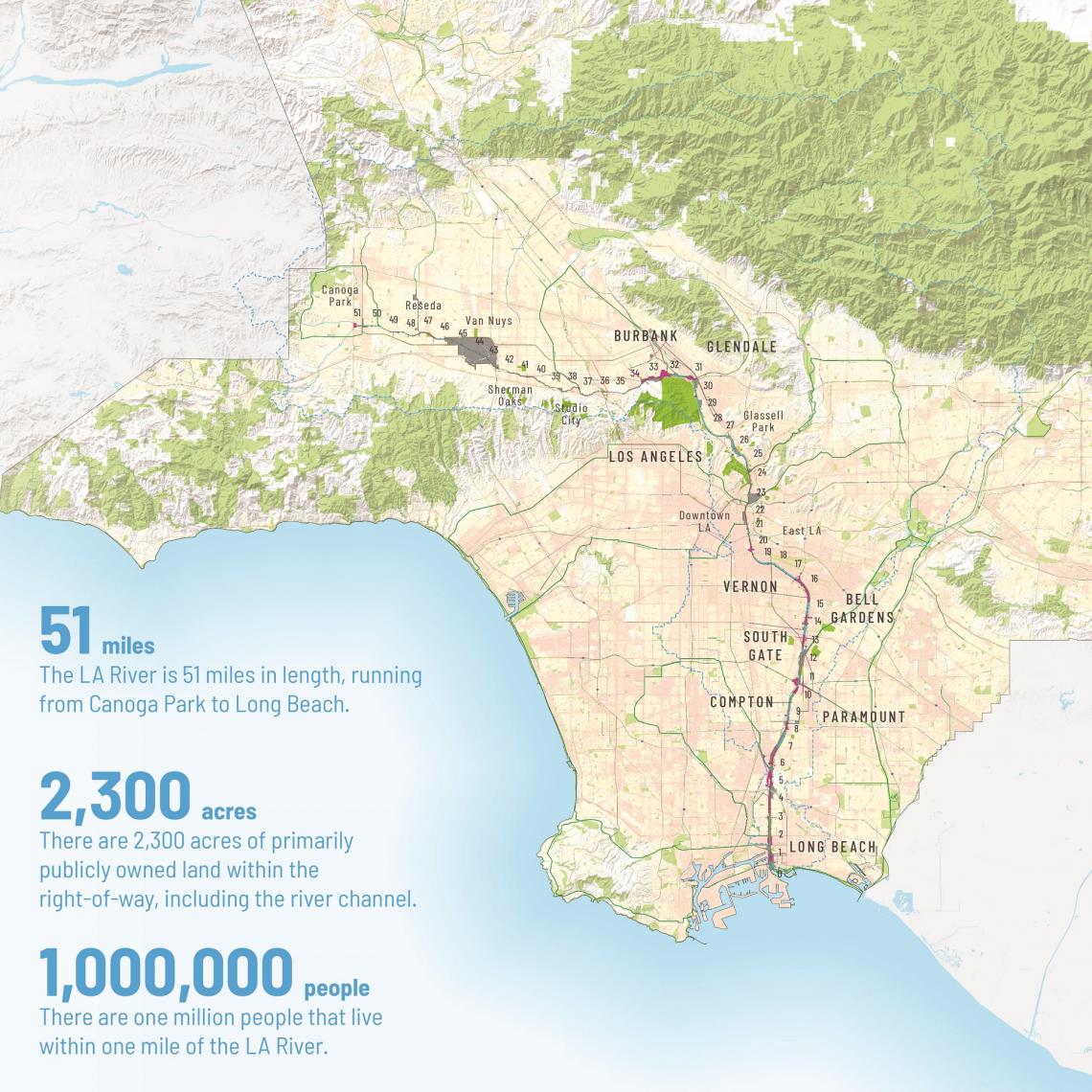
Mark Pestrella, the Director of the County's Department of Public Works, described the river as an asset for all Angelenos, noting that between its headwaters in Canoga Park and its outlet in Long Beach, it crosses through each of the five Supervisorial districts. The 51-mile corridor is home to more than 1 million residents, and is flanked by roughly 2,300 acres of publicly-owned land.
The bulk of that public property is used for flood control purposes, the legacy of a series of destructive storms in the early 20th century. The goal of moving water from city streets out to sea is famously the reason that much of the river corridor is encased in concrete.
However, sparse rainfall in Southern California mean's that the river is only needed for its flood control functions roughly 2 percent of the time, according architect Frank Gehry, who was tapped to work on the master plan in 2014. That creates an opportunity for recreational activities and public open space on much of the corridor.
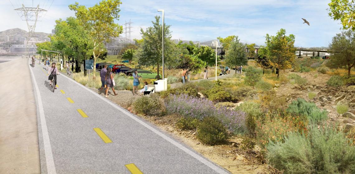
The scale of the Los Angeles River presents an opportunity which is unparalleled since the days of the Works Progress Administration, according Laurie Olin, a landscape architect who has partnered with Gehry on the master plan. Olin, who is a partner at the studio of the same name, envisions 100 miles of public trails along the river, as well as park projects that restore habitats and improve water quality.
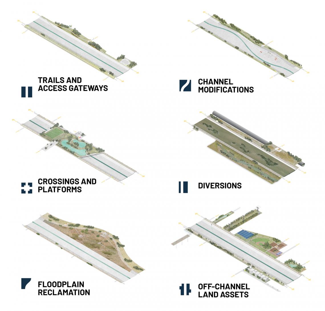
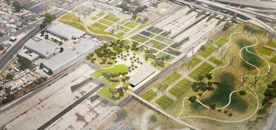
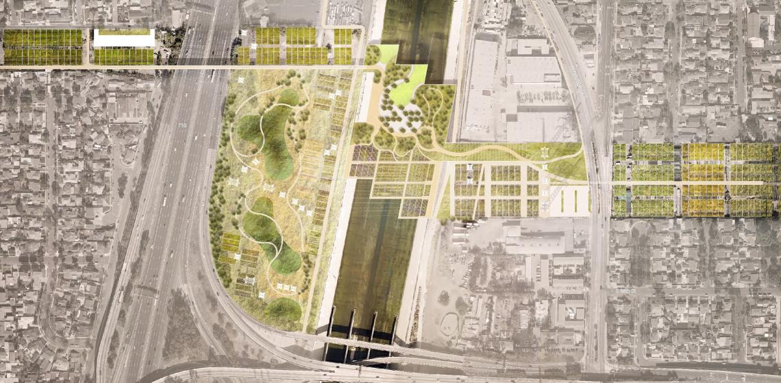
Although the master plan does not effectuate any specific investments along the river, the document identifies 56 potential projects between the San Fernando Valley and the South Bay. In addition to building off of existing proposals - such as a 42-acre park at the Taylor Yard or the Downtown leg of the L.A. River bike path - the plan includes a "kit of parts" outlining an array of improvements to the channel, ranging from more modest river trails to channel modifications and even flood plain reclamation.
Among the more ambitious concepts included in the plan are “elevated platform parks” which would mask the concrete channel rather than removing it. One such project could be located at the confluence of the L.A. River and the Rio Hondo in South Gate, adjacent to the City of South Gate's proposed "Urban Orchard." That site could served by Metro's West Santa Ana Branch light rail line, should a proposal for a new station from Supervisor Solis come to fruition.
A variety of funding sources could be tapped for the various L.A. River projects in the master plan, including existing voter-approved measures which provide money for storm water capture projects, homeless services, parks, and transportation improvements. Supervisor Kuehl also anticipates that a federal infrastructure bill - a likely priority for the incoming Biden administration - could also create a new source for grant funding.
In addition to its focus on open space, transportation, and water quality, the master plan also considers the externalities of new investment in infrastructure along the river corridor. The plan proposes to closely track the risk of displacement for residents near the waterway and steer investment in affordable housing toward those communities.
Supervisor Solis, in acknowledging the possibility of gentrification as a result of river projects, noted that she recently introduced legislation to expand the capacity for community land trusts to purchase buildings and property across Los Angeles County, with the goal of preserving them as affordable housing.
The draft plan is now available for review and public comment through March 14 at LARiverMasterPlan.org.