In a series of recent community meetings, officials from the Los Angeles Department of City Planning have unveiled new zoning and land use concepts to guide development in the Westside area.

The Westside community plans (Palms-Mar Vista-Del Rey; Westchester-Playa del Rey; Venice; and West Los Angeles) are among 35 similar documents which comprise the Los Angeles General Plan. The four Westside plans encompass a more than 27-square-mile area which borders the independent cities of Santa Monica, Beverly Hills, Culver City, and Inglewood, as well as the unincorporated communities of Marina del Rey and Ladera Heights.
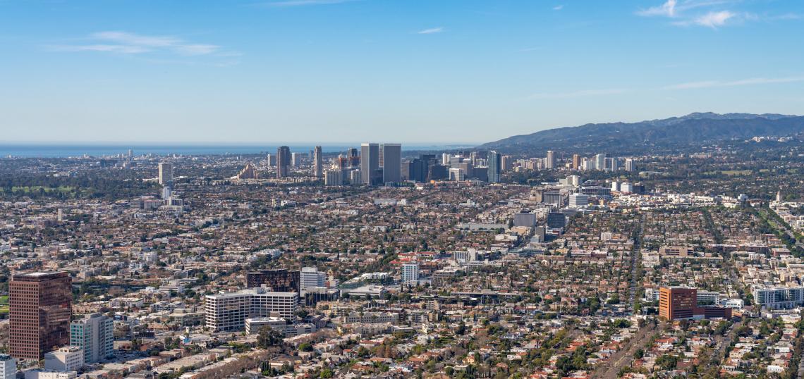
The Westside - one of the wealthiest areas of Los Angeles - is home to more than 290,000 residents and 150,000 jobs, due in part commercial hubs such as Century City and Playa Vista. Its residents are predominantly white, though there are also large Latino, Asian, and Black communities, and several historic ethnic enclaves such as Sawtelle and Tehrangeles.
As with much of the City of Los Angeles, the Westside's built environment is characterized by low-slung residential development bisected by wide commercial boulevards, with small pockets of high-rise development. The proposed updates to the Westside plans would continue to focus growth in existing commercial zones and multifamily neighborhoods, though some single-family blocks could be poised for changes.

In the West Los Angeles - which spans 7.1 square miles between Sawtelle and Pico-Robertson - the draft concepts propose concentrating new development on the area's commercial corridors - Santa Monica, Sawtelle, Westwood, Pico, and Overland - and in pockets near Metro D and E Line rail stations.
Radiating outward from Pico in Pico-Robertson and Westwood Boulevard in West Los Angeles, several strips of single-family zoned land would be rezoned two-to-four-story apartment buildings under the draft concepts, providing a transition from the commercial boulevards.
Other corridors - including Sepulveda Boulevard to the south of Expo/Sepulveda Station and the eastern side of Overland Avenue - would be zoned for "missing middle" housing such as duplexes and triplexes.
North of Expo/Sepulveda Station, Sepulveda's existing industrial zoning would be retained under the proposed concepts. However, new design standards would encourage future developments to orient their entrances toward the street, with parking placed in the rear.
The draft concepts also consider new opportunity sites for green space in West Los Angeles - specifically the Benedict Channel adjacent to Shacter Park in Beverlywood. Other flood control channels such as Ballona Creek have added multi-use paths along its banks.

The Palms - Mar Vista - Del Rey plan area consists of roughly 8.2 square miles of land, bisected by Culver City's Washington Boulevard peninsula.
Like its West Los Angeles counterpart, the draft concepts for Palms - Mar Vista - Del Rey concentrate mixed-use buildings on existing commercial corridors along Centinela Avenue, Jefferson Boulevard, Overland Avenue, Venice Boulevard, Sepulveda Boulevard, and National Boulevard. The Marina Marketplace - which is already slated for redevelopment - could also be rezoned to accommodate new housing and retail.
Additionally, several single-family neighborhoods would be rezoned to accommodate "missing middle housing," including properties along side streets Del Rey roughly between Alla Road and Centinela venue. Several of these blocks were zoned for multifamily development until the 1970s and 1980s.
Missing middle zoning is also slated for several blocks to the north and south of Venice Boulevard through the Mar Vista community, as well as in several sections of Palms.
Existing industrial zones in Palms, Mar Vista, and Del Rey would evolve to accommodate job-creating developments with limited residential buildings. Industrial sections of the community plan area include the Del Rey Loft District, Playa Vista, the Mesmer Triangle, and the section of Venice Boulevard adjacent to Culver City and the Metro E Line.
While the draft concepts do no propose large new open spaces the for Palms - Mar Vista - Del Rey plan area, the City has identified a flood control channel adjacent to the Mar Vista Gardens public housing complex as a potential opportunity site for a new multi-use path. The proposed path would feed into the existing Ballona Creek bike path and connect with Venice Boulevard via McLaughlin Avenue.

Venice - the smallest of the four community plan areas - spans approximately 3.1 miles adjacent to the City of Santa Monica.
The bulk of the proposed zone changes would occur in the neighborhood of Oakwood, which is dominated by single-family development today. The draft concepts proposed the creation of a new cultural heritage district to acknowledge Oakwood's importance to the African-American community, while also permitting the construction of new buildings up to four stories in height. Additional incentives would be made available to projects that include affordable housing.
Additional "missing-middle" zoning is proposed for the blocks which line the eastern side of Lincoln Boulevard, creating opportunities for one-to-four story structures as a transition between the commercial corridor and adjacent single-family development.
As with the other community plan areas, larger developments in Venice would be steered towards the area's commercial thoroughfares - namely Lincoln, Rose Avenue, Washington Boulevard, Abbot Kinney Boulevard, and Ocean Front Walk. While neighborhood serving businesses are intended for all corridors, larger structures would be restricted to Lincoln and Washington, while the other streets are envisioned with four-story height limits.
Pockets of industrial land adjacent to Venice Boulevard and Main Street would gradually evolve to permit some limited live/work development, in addition to traditional technology and job-creating uses.
While no new parks are being considered for Venice, the draft concepts propose that the Windward Avenue entrance to Venice Beach - site of the famous "VENICE" sign - should be converted into a pedestrian plaza.

The final Westside community plan - Westchester-Playa del Rey - includes the neighborhoods of Westchester, Playa del Rey, and Playa Vista, with LAX located to the south and the City of Inglewood to the east.
The draft concepts for the Westchester neighborhood propose gradual increases in density - particularly near Manchester Avenue's intersections with La Tijera and Airport Boulevards.
New limits development would steer construction away from the environmentally sensitive Westchester Bluffs - which overlook the Ballona Wetlands - while a proposed historic district would place limits on demolition in the beachfront Playa del Rey neighborhood.
Potentially the most significant changes are slated for Manchester Avenue, which is a significant commercial corridor in Inglewood and South Los Angeles, but is lined by the rear wall of single-family subdivisions in Westchester. The draft concepts now under consideration could introduce mixed-use zoning along Manchester, building off of existing commercial nodes at La Tijera, Sepulveda, Lincoln, and Pershing Drive.

In addition to the draft concepts, the Planning Department presentation solicits feedback on the possibility of either expanding or intensifying the development of the regional centers scattered throughout the Westside - including Century City, Playa Vista, and the Howard Hughes Center.
Additionally, the draft concepts consider potential future uses for the 17 acres of land in Mar Vista that are currently part of Santa Monica Airport - which is on track to cease operations in 2028. While the City of Santa Monica seeks to redevelop the entire site as a public park, Los Angeles could make its section of the airport - along with a 10-acre plot now occupied by a Santa Monica College satellite campus - available for the development of housing or commercial space.
The Planning Department is soliciting feedback on the draft concepts for the Westside plans through August 31. To provide comments, view the story map here.
An environmental impact report for the plans is tentatively scheduled to be released this Fall.
- Westside (Urbanize LA)